Inspired by some discussion in the Discord, I'm going to try something new, a book club readthrough of Samuel Eliot Morison's The Two-Ocean War, his single-volume history of the USN in WWII. It's a condensed version of his 14-volume History of US Naval Operations in WWII, an excellent work that is probably a bit too long for most people. Now, because even the "short" version is nearly 600 pages, I'm going to set the schedule of one chapter per week, which should average around 30 pages. I'll put up a discussion post each Wednesday with my thoughts (although I am going to do my best not to do very much research outside of reading the book) and everyone is free to comment. The first post, on Chapter 1, The Twenty Years' Peace, will go up on February 4th, a week from today. If you're interested, you can get the book here (Amazon affiliate link) and we'll see how this goes.
Naval Gazing Book Club - Two-Ocean War Ch4
Having kicked off the war at Pearl Harbor, our book club for Samuel Eliot Morison's The Two-Ocean War, a history of the USN in WWII, continues into Chapter 4, a survey of what else the Japanese were up to in the Pacific in the first few months of the war.
This chapter opens with a section that I almost really like, pointing out the execrable performance of MacArthur in the Philippines. And then the last word has to go and spoil it. Now, MacArthur is a complicated character, and I think his campaign in New Guinea was one of the great overlooked military masterpieces (unfortunately, it looks like it gets about 4 pages in Two-Ocean War, but the account in Morison's New Guinea and the Marianas is very good) but I also think he should have been sacked the instant he set foot on Australian soil. Based on this account, the performance of the Japanese air attack on the Philippine airbases is one of the very best of the entire war, and the sort of thing that even fairly rudimentary defensive measures could have gone a long way to mitigating. Also, there's not even a hint of acknowledgement that the whole plan was bad from the start. Whatever people may have thought the B-17 could do in 1941, it was not an effective anti-shipping platform and probably couldn't have done all that much to the air bases on Formosa, either, even if MacArthur hadn't let them get destroyed on the ground.
For fairly obvious reasons, Morison gives only the briefest account of the Malaya campaign, which was if anything even more badly conducted than the defense of the Philippines. After reading a book on it, I came away with the impression that the RN had done the best of the three services, and they lost two battleships.
But then we come to the campaign in the Dutch East Indies, which is one of the bits I like best in History of US Naval Operations, as it's almost totally neglected in most histories of the war, even more so than the Philippines. His description of Java Sea is excellent, finding just the right balance between detail and brevity. The one thing that stood out to me is how ineffective the Japanese torpedo attacks are, as my main reference frame for that is the fighting around Guadalcanal, where they did significantly better. But it's nice to finally see Morison hit his stride.
DASH
In the late 40s and early 50s, the USN and RN struggled to deal with a new underwater threat. Previous ASW techniques, worked out to deal with the slow, battery-limited submarines of WWII, were inadequate in the face of underwater-optimized vessels like the German Type XXI and its expected Soviet descendants. Initially, these were based around better versions of the systems developed during WWII, with longer-range sonars and Limbo and Weapon Alpha replacing Hedgehog and Squid.
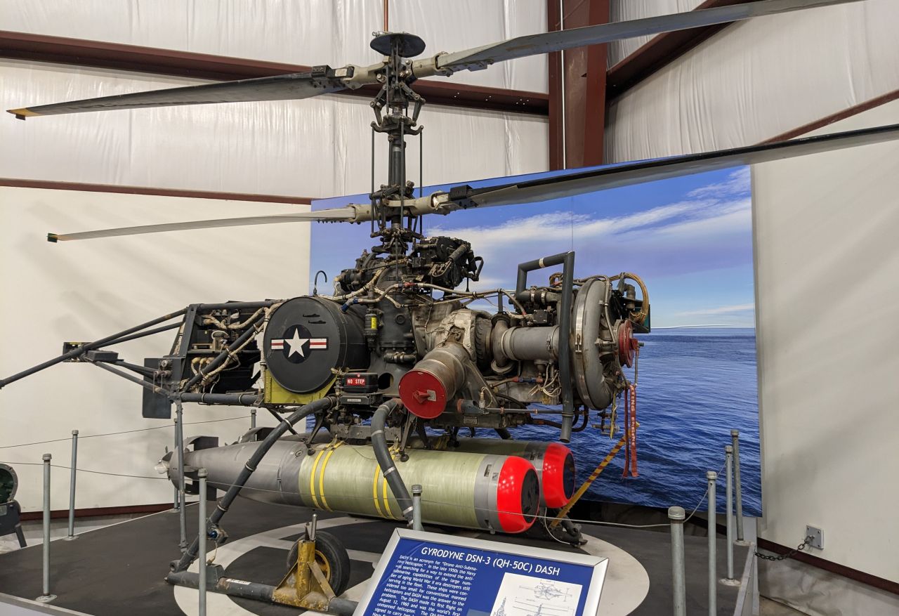
A DASH drone at Pima
But by the mid-50s, sonar ranges were getting close to 10,000 yards, way too far for those kind of depth-charge launchers to be effective. The submarine was moving, maybe unpredictably, and even if it was stationary, the sonar beams were wide and didn't give a precise enough location at range. Obviously, the homing torpedo was going to be at least part of the solution. First developed during WWII, it could handle quite a bit of uncertainty in the submarine's position by listening for the submarine and then homing in to blow it up. Initially, navies expected that the main long-range weapon would be heavyweight homing torpedoes, launched from the ship and wire-guided out to the point where their seekers could pick up the submarine. But it didn't work out that way. The big problem was simply that torpedoes were too slow for this to work well. A 40-kt torpedo, extremely fast for the time, would still take 7.5 minutes to reach a submarine 10,000 yards away, and the submarine could move significantly during that run. The obvious alternative was to deploy a smaller torpedo, probably one originally designed to be dropped by aircraft, through the air right on top of the submarine. Read more...
Naval Gazing Book Club - Two-Ocean War Ch3
This is Chapter 3 of our book club for Samuel Eliot Morison's The Two-Ocean War, a history of the USN in WWII. It's finally time for the real action to kick off, with the Japanese attack on Pearl Harbor:
One point I think Morison doesn't cover is the sheer improbability of the attack. It was a massive logistical stretch for the Japanese to pull off, with the carriers barely having practiced the necessary underway refueling techniques before departing, and the torpedoes arriving only two days before the attack. And it was only a few months earlier that the Japanese had even gotten enough carriers to pull off the attack. While it's easy to draw comparisons to Taranto, the British there were attacking at night, which meant they didn't have to worry about Italian aircraft, either over the target or attacking the carriers. The Japanese didn't have the ability to make a night attack like that, which meant that a lot of their force was going to have to be dedicated to hitting the American airbases, and Shokaku and Ziukaku didn't join the fleet until the second half of 1941. Without their airgroups, it would have been impossible to both hit the airfields hard enough to protect the carriers and do significant damage to the fleet.1 And the whole plan was insanely risky, and could have basically come unglued if, say, the duty officer had taken the radar operator's warnings more seriously. Ships would have been buttoned up and AA guns manned, and while we can't say for certain what would have happened, the vast majority of the damage done during the attack happened in those critical first few minutes. Read more...
Exotic Hulls Part 7 - Round Ships
I've previously covered a number of different exotic hull configurations in use today. But there have been a few from the distant past worth noting, most prominently the attempt by the Russians to build ships with circular hulls.
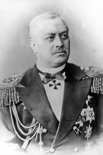
Admiral Andrei Popov
The story of these ships has its origins in the 1860s, when Russia was forbidden by the treaty that ended the Crimean War from operating more than half a dozen 800-ton2 coastal defense ships in the Black Sea. This was pretty small, particularly with the advent of ironclads, and thought soon turned to how to get the most out of this tonnage. It was clearly not enough for any conventional ironclad that could be competitive with vessels laid down by possible enemies like Turkey and Austria, so one Russian officer, Andrei Popov, proposed something radical. He had noticed that ironclads were generally growing shorter relative to their beam, as this made it more efficient to carry armor on a given displacement. Taken to its logical conclusion, a circular vessel would make most efficient use of armor, and while this would probably not be great for seakeeping or speed, a few small test boats worked well enough and it would also minimize draft, a serious concern for vessels designed to work in the shallow waters of the Crimean coast. Read more...
Open Thread 189
It is time once again for our regular Open Thread. Talk about whatever you want, so long as it isn't culture war.
Overhauls are Russian Battleships Part 2, Carrier Doom Part 3, Early US Battleships, Ship Structure and Strength, Squalus, The Pre-Battlecruisers, Hornet Part 2 and for 2025, The 2024 Brown Award Post, We need to talk about ship names and reader Alex's review of the RAF Museum Cosford.
Naval Gazing Book Club - Two-Ocean War Ch2
Probably the biggest limitation on Two-Ocean War's battle history is the fact that ULTRA, the British program to decrypt and disseminate German Enigma traffic, was not declassified until a decade after it was written. This shows up early in this chapter, where it talks about the futility of hunting groups as opposed to convoys. In fact, hunting groups were used, particularly in the spectacularly successful campaign against the German U-boat tankers in 1943. More broadly, the questions of the appropriate strategy against submarines is a complicated one, and the fact that WWI and WWII came to similar answers is somewhat coincidental. (If you want more on this, there's a good summary in Norman Friedman's new Cold War Anti-Submarine Warfare.)
Also worth commenting briefly on is that, yeah, in retrospect the fall of France was pretty improbable. The German generals who told Hitler it would be a disaster were, by conventional lights, quite right, and it wouldn't have taken all that much for it to actually be a disaster. But instead, France fell, and we got the war as we now know it.
Beyond that, we're seeing Morison's tendency (with one notable exception) to lionize American figures on full display here. King is also famous as "the most even-tempered man in the Navy - always in a rage", which doesn't really come across in the description. He was definitely a competent and effective admiral, but I don't think Morison's superlatives are entirely deserved.
On the Pacific side, there's more of the same problems that showed up in the first chapter. I will note, for instance, that his count of fleet strength doesn't include Repulse and Prince of Wales at Singapore, or the Dutch and Australian cruisers in the southwest Pacific. His evaluation of Yamamoto's strategy is also off. The basic outline is not difficult to follow given modern sources. Yamamoto was trying to deliver a major shock to the US in hopes of forcing us out of the war, and, failing that, to give Japan time to expand and fortify her perimeter. I don't think his account of the politics on Japan's side is much better, but it's been a while since I read much on this. If anyone is interested in a recent and quite readable book on this, I'd recommend Tower of Skulls by Richard B Frank (Amazon affiliate link).
Despite my criticisms, I think this chapter was an improvement on the last one. The Atlantic side was the first time we've seen Morison's genius for describing the operational side of things, and next time out, we'll get his account of the Japanese attack on Pearl Harbor, which will play far more to the book's strengths.
Museum Review - Museum of Flight
As regular readers know, I'm a big fan of air museums, and have been to (and reviewed) almost all of the major air museums in the US. The last really big one that I hadn't been to was the Museum of Flight in Seattle, and on a recent visit there to see family, I finally made it, and quite enjoyed what I found.
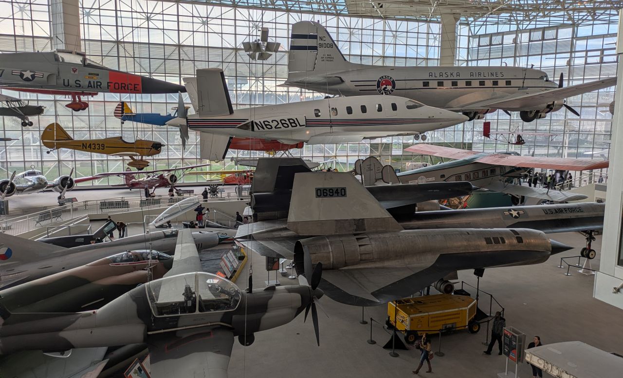
I should probably start by saying that the Museum of Flight isn't really one museum. It's more like three or four different museums in a trenchcoat, all stuck together on a campus near Boeing Field in Renton, south of downtown Seattle, which is also the home of the 737 production line.3 There's a pretty cool collection of warbirds from both World Wars, a very neat exhibit inside the Red Barn that served as Boeing's first factory on how early airplanes were built, an uninspiring space museum and a somewhat random collection of other planes, both indoors and out, that definitely showed the museum's connection with Seattle's biggest airplane company. But there's not a lot of coherence here, and the campus layout is even more obviously the result of a staged expansion than the Stafford Museum, the previous holder of the title. Read more...
Naval Gazing Book Club - Two-Ocean War Ch1
Today is the first chapter of our book club for Samuel Eliot Morison's The Two-Ocean War, a history of the USN in WWII. The first chapter, The Twenty Years' Peace, covers the interwar years, and as usual, I'll kick off by sharing my thoughts on the chapter:
This is a chapter that has not held up very well to the last 60 years of naval history, probably because it is a very different type of history from the rest of this book. Understanding the broad sweep of events in peacetime is very different and more difficult than describing a battle in war, and Morison was still writing in an era when many of the players were still alive and grinding axes. In particular, views on the naval treaties have shifted radically, and you'd be hard-pressed to find a serious historian today who doesn't think that they were on the whole probably a good thing for all involved, because they kept a major naval race from kicking off in the early 20s and gave navies a target to build to during the Depression. There's also a general downplaying of the interwar USN that doesn't seem particularly coherent or match more recent works I've read. It's probably easier to see flaws when you're still that close to events, and bitter that the Navy didn't get more money in the 1930s. I suspect this is based on the introduction, written by Dudley Knox, to Vol 1 of History of US Naval Operations, and it suffers from a lot of the same flaws. Also, it's pretty clear that Morison is allowing his friendship with Roosevelt to color his evaluation of FDR's presidency. (That's how he got the job writing the history of the USN, for anyone who doesn't know.) For one thing, Roosevelt didn't really begin a serious naval buildup until after the Fall of France, 5 years after the Japanese withdrew from the treaty structure. His policy before that was far less clear than is often painted in retrospect, and Morison isn't alone in this.
A couple of technical fact-checks: The 1930 London Treaty did impose tonnage limits on smaller ships, contrary to what Morison claims, and it appears that Earl Ellis died of alcoholism, not Japanese perfidy. And Anglo-American relations were nowhere near as calm and certain in the 10s and 20s as Morison makes out. Also, I spent a few minutes looking into his comments on Hoover, which are true as far as they go, but seem to have been more because Hoover was vaguely interested in disarmament and very distracted by domestic affairs than by the sort of specific animus Morison ascribes to him.
All that said, I expect things to improve as we get deeper into the book. Next week is Chapter 2, Short of War, covering the period before America's entry into WWII.
Relevant Naval Gazing posts:
Carrier Operations Part 4
The practice of operating aircraft at sea evolved rapidly from the earliest days of naval aviation through the introduction of the true aircraft carrier immediately after WWI, and was refined as more navies got into the game in the 20s. These in turn formed the basis of carrier operations through 1945, although some changes were necessary, largely to deal with the increasing weight of aircraft through the 1930s.
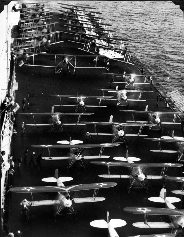
T4Ms (back) and F3Bs on a carrier deck, c.1930
The typical carrier aircraft of 1930 was a biplane, relatively light and with a lots of wing area to generate lift. For instance, an American air wing might be composed of Boeing F2Bs (gross weight 2,805 lb, wing loading 11.5 lbs/ft2), Vought O2Us (gross weight 3,635 lb, wing loading 11.4 lbs/ft2) and Martin T4Ms (gross weight 8,071 lbs, wing loading 12.3 lbs/ft2). But by 1941, the same carrier would be carrying an all-monoplane wing of Grumman F4Fs (gross weight 7,423 lb, wing loading 28.6 lbs/ft2), Douglas SBDs (gross weight 10,855 lb, wing loading 33.4 lbs/ft2) and TBDs (gross weight 10,194 lb, wing loading 24.2 lb/ft2). To an extremely rough approximation, takeoff and landing speeds scale with the square root of wing loading, so the 1941 air group would need to be going 40-70% faster than their predecessors of a decade earlier to take off or land. In practice, this requirement was mitigated somewhat by the switch from biplanes to monoplanes, which are more aerodynamically efficient, and the adoption of high-lift devices like flaps and slats that allowed the aircraft to stall at lower speeds.4 Despite this, they still would require stronger arresting gear and more room for takeoff, limiting the number of airplanes that could operate from a given ship. Read more...
Jet Fighter Generations Part 2 - Third and Fourth Generations
Today, we continue reader Michael Tint's series on the history of the jet fighter, cataloging the changes that came with each generation of aircraft. He previously covered generations 1 and 2, the subsonic and early supersonic aircraft.
Gen 3
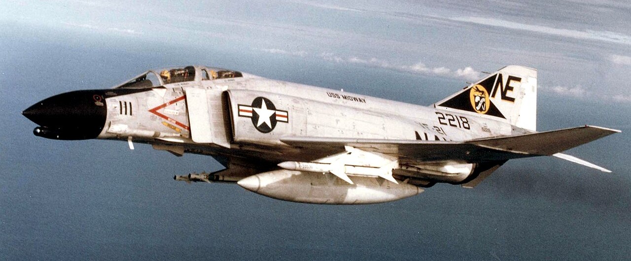
An F-4 Phantom, the definitive Gen 3 jet fighter
The 1960s saw the emergence of Gen3 fighters, marking the moment electronics ceased to be accessories and became the heart of the aircraft’s design. As radars became mandatory for tracking and radar guided missiles became the primary means of engagement, the fighter demanded more. More internal volume to house powerful radars and electronics, more hardpoints to carry more and bigger missiles, more thrust to keep up the speed, and more fuel to keep it all going. This is the era when the nimble dogfighter of old was replaced by the complex integrated weapons platform. Read more...

Recent Comments