September 01, 2023

Open Thread 138

It's time once again for our regular open thread. Talk about whatever you want, so long as it isn't culture war.

Overhauls are Underwater Protection Part 2, A Brief Overview of the United States Fleet and for 2022, The American Secrecy System and Submarine Espionage.

August 27, 2023

Military Spaceflight Part 6 - Navigation

Both recon satellites and communications satellites provide useful capabilities on their own, but when combined with a third type of satellite, they are truly revolutionary. The last 25 years have seen warfare changed by the advent of cheap smart weapons that can be guided to positions supplied by platforms far away from the shooter, a capability that fundamentally rests on satellite navigation. More than that, satellite navigation has become a vital public utility, the greatest direct service the military provides the civilian world.


A sailor shoots the sun aboard USS America

The use of space for navigation goes back thousands of years, thanks to the use of stars as fixed points. The Polynesians were the first to use this for oceanic voyages of astonishing scale, while improved techniques were vital to European exploration in the Age of Discovery. Latitude is easy enough to find from the height of Polaris above the horizon, or the height of the Sun at noon. Longitude is more difficult, lacking as it does a straightforward physical reference, and has to be determined by the difference in time between a known location and the location of the navigator. This can be done by precisely calculating the time of an event in the sky, such as the Moon eclipsing a specific star, but this is difficult to observe, particularly on a ship at sea. A better solution came in the form of the chronometer, a clock designed to keep regular time despite the motion of the ship. These methods were standard up until the 1940s, and are still taught today as backups in case everything else fails. Read more...

August 20, 2023

Military Spaceflight Part 5 - Communication

Modern warfare runs on information. Forces in the field produce increasing amounts of data, and rely on data from other sources to find and engage the enemy. Bandwidth is the second most precious commodity on the modern battlefield, behind only time. And the vast majority of that bandwidth is supplied by satellites.1


The first communications satellite

The initial impetus for military satellite communications came out of the problems of the nuclear age. High-frequency radio had long been the best way to send messages to mobile recipients over long distances, but it relied on bouncing off the fickle ionosphere. This was unacceptable when the credibility of the US deterrent rested on the ability to reliably order forward-deployed bombers2 and carriers to attack. The obvious solution to all of this was to replace the ionosphere with a more reliable reflector, and a number of options were investigated, including the Moon (a spinoff of plans to use the Moon for SIGINT), the ionization trails left by meteors, a giant orbital balloon and a reflective layer of orbital needles. Of these, only the meteor trail method ever saw wide operational use,3 although bandwidth is limited and the most prominent user today is the SNOTEL system for reporting snow depth in remote areas. Read more...

August 18, 2023

Open Thread 137

It's time for our regular open thread. Talk about whatever you want so long as it isn't culture war.

I will again remind people that Naval Gazing has a discord, and that we do things besides naval stuff there. General is often active with random stuff, and we have a dedicated Bulbasaur channel if anyone wants to talk about Pokemon.

Overhauls for 2022 are Speed and Range in Battleships and Southern Commerce Raiding Part 7.

August 13, 2023

Nuclear Weapons at Sea - Trident Part 3

The introduction of the Trident C4 still left the overall Trident program with an unresolved issue. The new Ohio class submarines were being built with much larger missile tubes than were required for the Poseidon/Trident I, and a new missile had been promised to fill them. What that missile would look like was an open question. Initially, the plan had been to increase range from the 4000 nm of the Trident I to as much as 6000 nm, allowing the missile to reach Moscow from a submarine off the coast of South Africa. But this seemed unnecessary, and a number of factions within the defense establishment instead began to push for better accuracy, giving the new missile a true hard-target capability that previous SLBMs, focused on retaliatory attacks on enemy cities, had lacked.


A Trident II is launched from Nebraska

Much of this drive came from a shift in US nuclear strategy, which began to turn away from the all-out nuclear war in the early 70s. Secretary of Defense James Schlesinger wanted more options to attack Soviet nuclear forces, and pushed the SPO to improve the accuracy of their missiles, starting a program to better understand the sources of error in the existing missiles, with the hopes of improving not just the Trident I but also the Trident II. Several options came out of the program to reduce CEP,4 including fitting a receiver to use the new GPS satellites, a radar sensor that would look at the terrain as the warhead came in, and improvements to the stellar-inertia guidance system used on Trident C4. Eventually, the last option won out, due to concerns about the reliability of GPS during a nuclear war and a lack of confidence in the radar seeker, particularly due to issues with testing against inland targets. Read more...

August 06, 2023

Military Spaceflight Part 4 - Sea Surveillance

In previous parts, we've discussed the basics of spaceflight, optical recon satellites and other types of recon satellites, but there has been one glaring omission. So far, all of these systems have been directed against land targets, but satellites could also help solve the problems of finding ships far out at sea.


A Soviet Tu-16 recon aircraft flies past a US destroyer

The Soviets were the first to take a serious look at this problem, needing as they did some way to find the American carriers, armed with nuclear weapons, for their missile-armed bombers and submarines. Initially, they planned to get a rough fix using shore-based direction-finding apparatus, supplemented with long-range scout bombers. But as the Americans switched away from the use of HF radio, the DF system became less useful, and satellites were the obvious solution. Optical detection was clearly out, given its inability to see through weather and the problems of scanning the entire ocean, then processing and downlinking the data. A radar system would work much better, as it could penetrate clouds and automatically detect targets, greatly reducing the amount of data that needed to be sent to the ground station. Read more...

August 04, 2023

Open Thread 136

It's time once again for our regular Open Thread. Talk about whatever you want, so long as it isn't Culture War.

Overhauls are German Battleships in WWII and for 2022, NWAS Trident Part 1 and my take on the Light Amphibious Warship.

July 30, 2023

Military Spaceflight Part 3 - Other Recon Satellites

Although imaging satellites are the most prominent and best documented form of recon satellites, they are far from the only platforms to carry sensors into space for military purposes. The most common use is signals intelligence (SIGINT), taking advantage of the fact that radio waves generally travel in straight lines well past their target, and can be picked up by a passing satellite. Antennas also produce sidelobes that point in different directions from the main lobe, and satellites can often pick up signals in the lobes pointing up. Lastly, a snooping satellite can make use of the fact that radar signals have to be quite powerful to create a useful return, so even a simple receiver is usually enough to pick up a one-way signal.


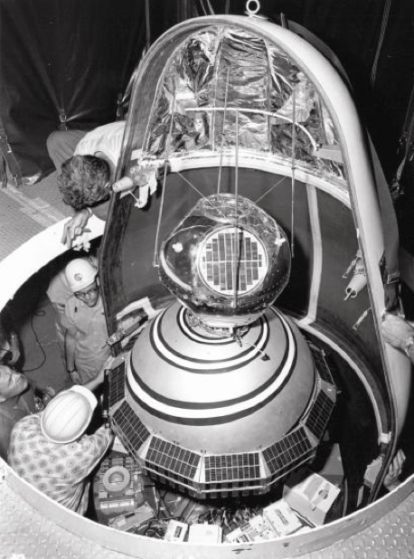
GRAB/SOLRAD-1 is prepared for launch atop Transit 2A

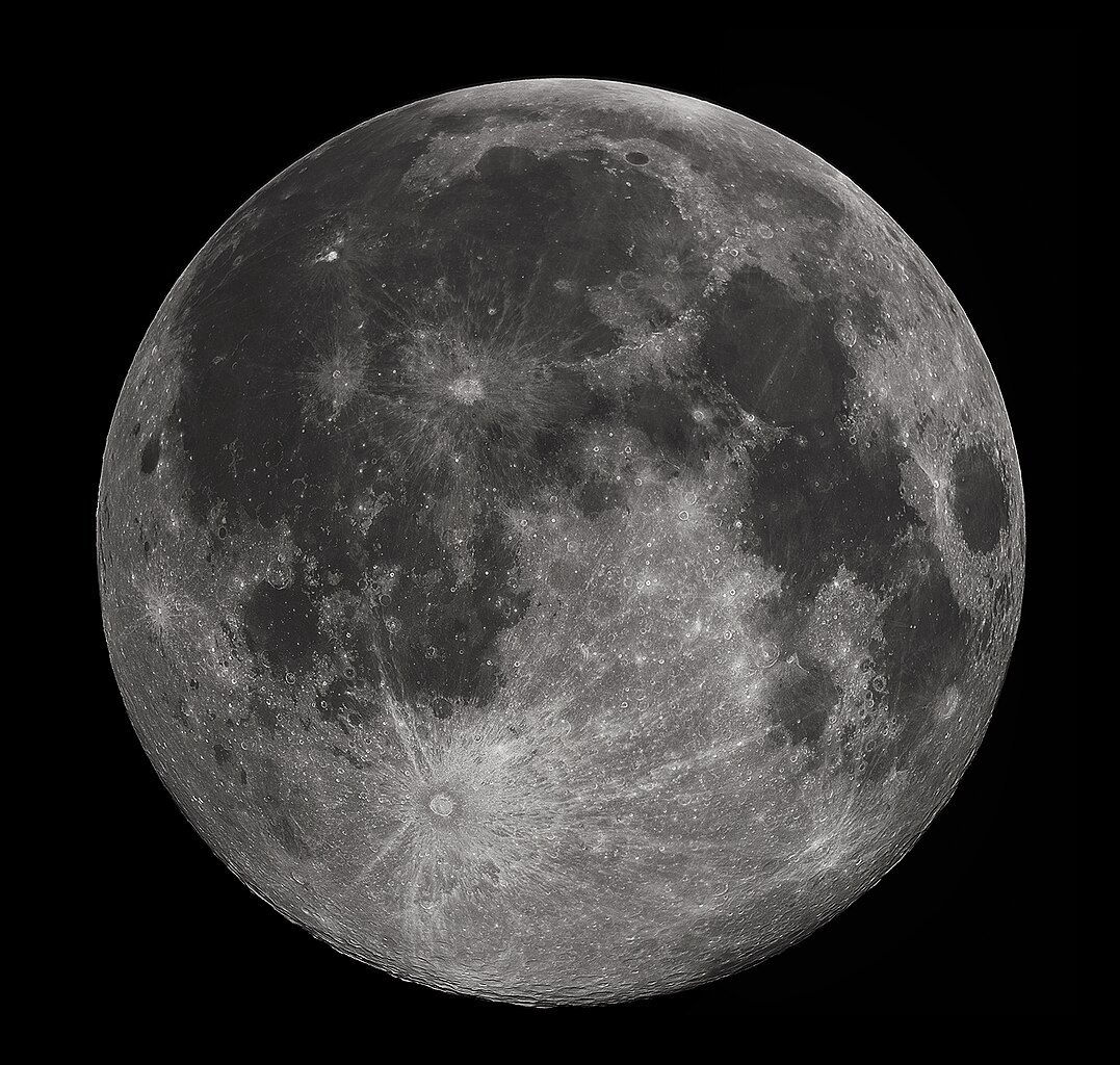
In fact, the first plans to make use of these properties predate spaceflight itself. In the late 40s, engineers realized that they might be able to measure the signals of Soviet air-search radars by listening to signals reflected off the Moon. Initial tests found that the Moon was a surprisingly good reflector, but the cost of an operational program, and the development proper of SIGINT satellites, killed it off.

SIGINT satellites were planned from early on in the American space program, and a system known as GRAB (officially Galactic Radiation And Background, in fact simply for what it would do to Soviet electronic transmissions), was the world's first successful spy satellite. The satellite, with the cover name SOLRAD 1, was launched as a secondary payload with the Navy's Transit 2A navigation satellite and despite weighing only 19 kg incorporated not only the SIGINT system but also a very real science capability, passing significant data on the Sun's X-ray signature. When in SIGINT mode, it was a simple transponder, relaying the signals it picked up to the ground station, where they were recorded for analysis. This gave not only the performance characteristics of the radars, but also their location, thanks to the use of doppler shift and a bunch of math. These were largely focused on Soviet air defense radars, vital information for both Navy and Air Force as they planned nuclear strikes on the USSR. Read more...

July 23, 2023

Museum Review - Fort MacArthur

While in LA for the Naval Gazing Meetup (it was great, you should have come) I took the chance to visit the remnants of Fort MacArthur in San Pedro, not far from Iowa. I hadn't been interested in the field until a few years ago, and for various reasons hadn't been able to get there since.


The 14" disappearing battery at the main site5
Type: Coastal defense sites
Location: San Pedro, CA
Rating: A nice enough place to visit if you have the time
Price: Free

Website

Fort MacArthur was established in 1914 to protect the growing city of Los Angeles as part of the Taft board's expanded program of fortifications. Initially, it was equipped with a quartet of the standard 14" disappearing guns and eight 12" mortars, as well as mines and smaller guns to cover the entrance to the Port. These were supplemented in the interwar years by a pair of 14" railroad guns. The fort was not particularly popular with the neighbors, who complained of broken windows, and the railroad guns were often moved up and down the coast to allow the crews to train. After the outbreak of war, there were serious concerns that the Japanese would attack, and the existing defenses were bolstered by the addition of a pair of 16" guns in casemate mounts a little ways up the coast, and another battery was planned down the coast in Orange County. These were armed with the 16"/50 Mk 2 guns designed for the WWI-era South Dakota class, and while the Orange County battery was cancelled in 1944, the battery near MacArthur was among the last ever completed by the United States. Read more...

July 21, 2023

Open Thread 135

It's time once again for our regular open thread. Talk about whatever you want, so long as it isn't Culture War.

Since the last discord meetup worked quite well, I'm going to hold another one next weekend, 7/29, at 1 PM Central (GMT-6). Discord link is in the sidebar if you want to join, or if you just want to hang out in the regular channel.

Overhauls are Signalling Part 4 and for 2022, Corrosion at Sea and my review of Hornet.