
I've previously gone over the various capabilities that space systems bring to the military, ranging from reconnaissance to communications to navigation. But anything that provides such a capability is obviously going to turn the military mind to countermeasures.
At this point, it would be easy to immediately launch into a recounting of the various and delightful ways that people have come up with to blow up satellites, but that would be premature, because a great deal of the time and energy involved in counter-space work has been spent on keeping track of what is going on up in orbit. After all, it's rather difficult to blow up satellites if you don't know where they are, and very easy to blow up the wrong one if you don't know what they are, not to mention all of the other things you can do with this information.
Battleships, bits thereof
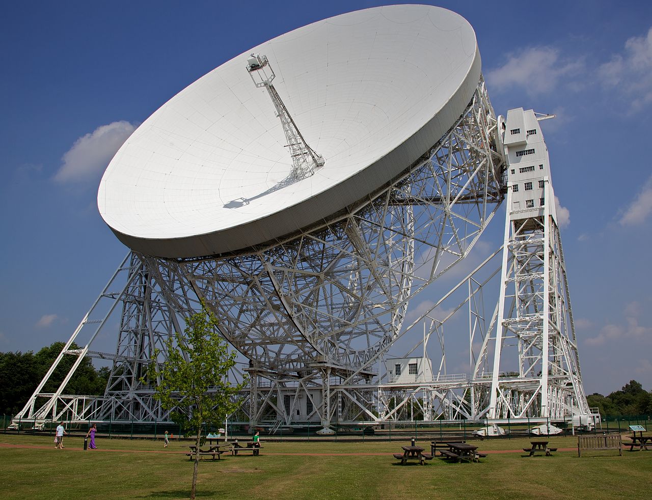
American efforts in this area date back to the late 50s, when the imaginatively-named Project Space Track was established to track all of the stuff we were sending into space. The primary way of doing this was by listening to their radio signals, which could be turned into orbital tracks with a lot of math, a technique that had surprising applications for navigation. They also made use of existing radars, such as the radio telescopes at Jodrell Bank in England,1 as well as radars built to track Soviet missiles, either in testing or in operation. Optical observation was also used, including Operation Moonwatch, which enlisted civilian volunteers to provide observations, starting a legacy of amateur satellite tracking that continues to this day and provides surprisingly detailed data on secret military space operations. Space Track soon gave way to the even more imaginatively named Space Detection and Tracking System, the successors of which continue to track basically everything in orbit around the Earth to this day.

A Space Fence transmitter
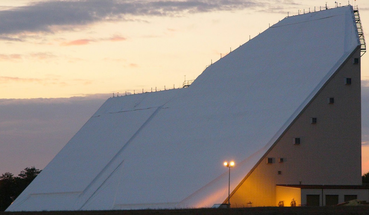
Most of this is the responsibility of the United States Space Surveillance Network,2 operated by the 18th Space Defense Squadron of US Space Force's Space Delta 2.3 This makes use of a number of sensors to feed a single catalog of every object in space, most of which is also shared with the public.4 The problem is that space is really big, which makes searching it with a conventional radar difficult. Instead, initial detection is the responsibility of the rather unusual "space fence". The original fence, formally the Air Force Space Surveillance System, was established in the late 50s by the Navy5 and was a multistatic radar with three transmitters and eight receiver stations scattered across the United States along the 33rd parallel. Clever use of signal processing meant that any satellite which passed over the array (which in practice was effectively all satellites with an inclination of 33° or more) would be picked up, giving it far better capability to detect unknown satellites than any other sensor. The original fence was decommissioned in 2013, and replaced by a new version, actually called "Space Fence", located closer to the equator, at Kwajalein in the Marshall Islands, and reportedly capable of tracking a marble in LEO. Unfortunately, details on this system are sparse, but it remains the only system capable of reliably detecting new objects which aren't transmitting.
The AN/FPS-85
Satellites which are transmitting can of course be picked up by passive sensors, and the US apparently has two systems to do so, named with the usual imagination "Deep Space Tracking System" and "Low Altitude Space Surveillance System". Unfortunately, virtually no other information appears to be publicly available, although it is also worth noting the use of booster telemetry to alert the network to a new launch. And for targets where there is at least a rough idea of location, the network can rely on more conventional radars than the space fence, mostly those designed to detect objects in very low and very unstable orbits. These include systems such as PARCS, PAVE PAWS/BMEWS and Cobra Dane, all very large and very powerful phased arrays. The largest and most powerful is the AN/FPS-85 at Eglin AFB, the first big phased array and the most powerful single radar ever built. Designed to keep a watch on America's southern flank in case the Soviets started lobbing warheads the long way around, it is reportedly capable of tracking a basketball in geosynchronous orbit.6
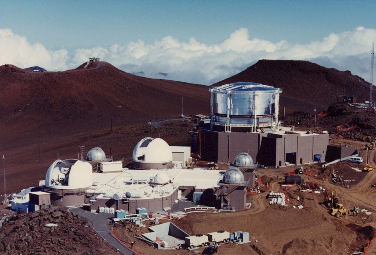
Telscopes on Maui
But detecting that there is something in space is only half the problem, because for many things, figuring out what it does really matters. And this isn't really a job radar can do.7 Instead, this falls to intercepted communications and several optical tracking systems, which make use of quite large telescopes to image satellites flying overhead, giving analysts a clear idea of the role and capabilities of hostile satellites. These include GEODSS, which uses three sites to image satellites in deep space using 40" telescopes and replaced a similar system that used film cameras, the Maui Space Surveillance System, which has several telescopes including the 3.67 m Advanced Electro Optical System Telescope, and the Space Surveillance Telescope in Western Australia.
Space-Based Space Surveillance
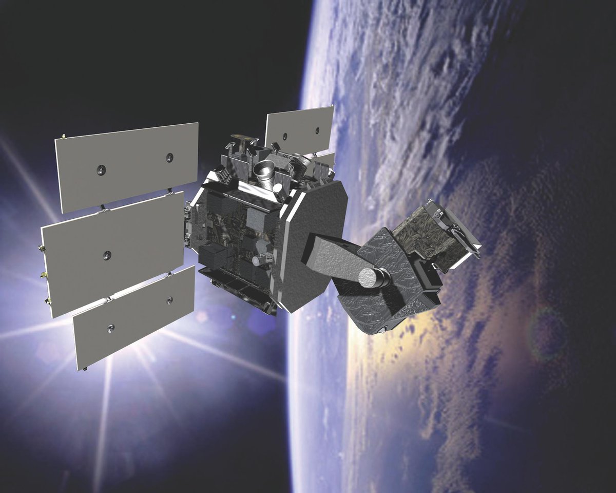
Nor are all of the sensors on the ground. Systems like DSP and SBIRS are useful for tracking launch vehicles on the way up, allowing an early look at the satellite's orbit, which in turn generally gives a good idea of what it is for. Once in orbit, the ground-based sensors are usually the most effective way of keeping tabs on it, with one exception. Geosynchronous satellites stay over one area, which means that if they're somewhere the ground-based systems can't reach, then the US is out of luck. Also, because of how high they are, the ground-based optical systems may not work as well as they do for LEO satellites. The solution is to put the sensors on satellites, in the form of Space-Based Space Surveillance, which images GEO satellites regularly from LEO, or the Geosynchronous Space Situational Awareness Program, which operates in a near-GEO orbit, allowing much closer, but less frequent, passes.
The first and most obvious reason for all of this is that knowing what the enemy is doing allows you to take countermeasures. If you know when the enemy recon satellite will be overhead, it makes it much easier to test your latest and greatest toys while still keeping them hidden. This is particularly important for naval forces, who can't exactly hide inside and would instead need to do things like assume a specific course during a RORSAT pass to hide from its radar. This was considered important enough that a dedicated system was built to push this information out to the fleet, and probably explains why the original space fence was run by the Navy until 2004, when the Air Force finally stole it.
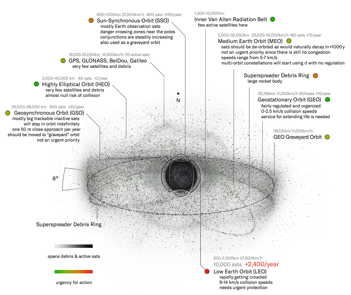
But the space surveillance system's responsibilities extend beyond tracking hostile satellites, to the increasing problem of orbital debris. Because stuff in space tends to stay there,8 old satellites, rocket boosters, and pieces of the same are a hazard to operational satellites, and the space surveillance system does its best to mitigate this by providing a catalog of debris to everyone. These days, there is significant awareness of the debris problem, and low-altitude satellites are required to deorbit within five years of the end of their mission, but the increasing number of satellites means that accidental explosions and collisions (or some idiot blowing up their own satellite in a weapons test) keep the debris level high, with somewhere between 25,000 and 37,000 objects of 10 cm or larger estimated to be in orbit as of 2024. The worst case, so far unrealized, is Kessler Syndrome, where the debris density is high enough that each collision causes another in a chain reaction, rendering LEO nearly uninhabitable.
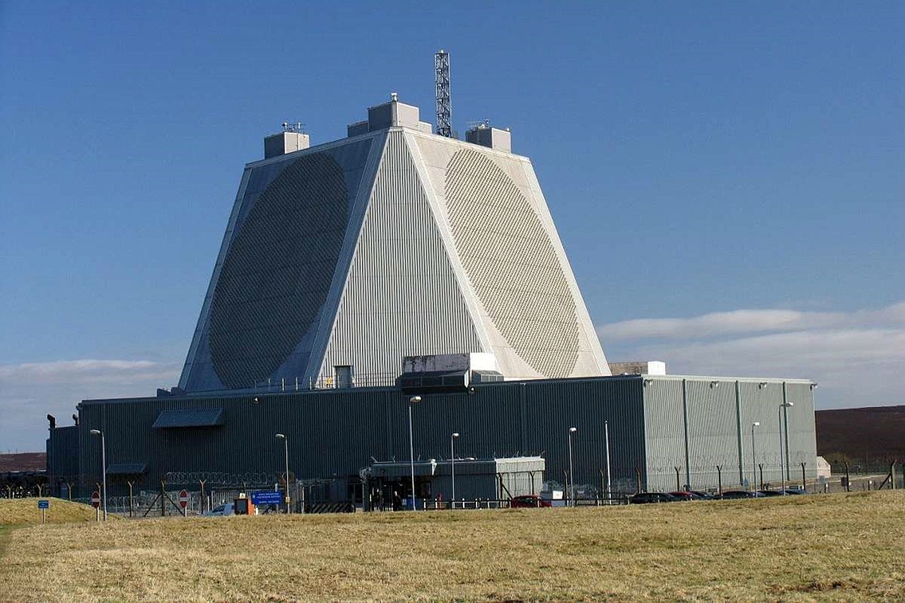
BMEWS radar at RAF Fylingdales
Obviously, not everyone is willing to rely on American data for space surveillance. Besides the amateur satellite-spotters discussed earlier, the Russians have the Main Centre for Reconnaissance of Situation in Space, which includes the use of ABM radars, the Krona radar/optical site and the Okno optical surveillance system in Tajikistan, along with the Moment ELINT system. The European space agency has the Space Situational Awareness Programme9 which includes scientific radio and optical telescopes, as well as the missile-warning radar at RAF Fylingdales and the French GRAVES bistatic radar. Information on Chinese space surveillance systems is effectively nonexistent, but I am confident that they are working along similar lines.
OK. All of this is interesting, but let's say war has broken out and we want to make the orbital debris problem much worseshoot down the other guy's satellites. This is the realm of kinetic ASAT, a subject we will turn to next time.
1 Naval connection: the big Lovell Telescope at Jodrell Bank is turned by a mechanism built from the traversing mechanisms of 15" turrets from Revenge and Royal Sovereign. ⇑
2 I can only assume that Moonwatch was an anomaly and named by someone outside the professional space community. ⇑
4 You can guess which bits aren't. As noted above, there is a dedicated amateur community which makes sure that these gaps are filled in. ⇑
5 Who called it the "Navy Space Surveillance System" or SPASUR. ⇑
7 Well, mostly. There is the Haystack Ultrawideband Satellite Imaging Radar, which uses several different radio bands and a lot of signal processing witchcraft to get something like an image of a satellite going overhead. It also gets bonus points for not having the word "Space" in the name. ⇑
8 More or less, anyway. There is a little bit of drag in space, particularly in low orbit, and while you can pretty much ignore it in the short term (days to maybe a week or two), things do decay over time. Decay is faster in low orbits or for things with low sectional density (mass/area), which in practice mostly means small things. ⇑
9 Distinguishable from a US program namme only by spelling "program" wrong. ⇑
Comments
Mistake in Footnote 9, you've called the correct spelling of programme wrong (and maybe done some others).
So it probably couldn't detect a teapot in most of the space between Earth and Mars?
In footnote 9, on a different note from Anonymous's Anglophile complaint: you wrote "US program namme."
Please tell me this was intentional, because that's hilarious.
Yes, that was intentional.
"Space," it says, "is big. Really big. You just won't believe how vastly, hugely, mindbogglingly big it is. I mean, you may think it's a long way down the road to the chemist, but that's just peanuts to space.
That's ESA, not EASA.